Details, details....
I spent my Friday night putting together our group's first aid kit and watching "Say Yes to the Dress" - I know how to have fun.
So far, this is what we have in the kit:
Ibuprofen - ~100
Tums - 3 travel size rolls
Zyrtec - 15 pills
Chewable pepto - 36
Sterile needles/syringes - 4
Acetaminophen - 20 tabs
Hydrocodon - 18 (Rx with Tylenol)
Tegaderm bandages - 2
Nextcare large waterproof bandages - 3
Large nonstick dressing - 2
Sterile gauze pad - 4
Anti itch cream
Antibiotic cream
Wound cleaner
Small duct tape
Paper tape
Alcohol swabs - 12
Scissors
Benadryl - 12
Nauzene (for nausea) - 20
Assorted blister band aids (multiple day use) - ~18
Regular band aids - small spots to large bandages - lots
Coldeze cough drops - 15
Tweezers
Nail clippers
Nail file
I'm hoping we don't even need 10% of what I'm planning to bring, but I'm sure if there is something we don't bring, we will inevitably need it.
Friday, July 5, 2013
Training Preparation: Rob and Bekah hike Mount Massive Jul 3, 2013
Rob and Bekah extended the Colorado trip past the Leadville Heavy Half trail run for some training hikes up a couple of the 14'ers. "14'ers" are the name for summits above 14,000 ft elevation... and apparently people "collect" hiking all of them. There's a checklist and everything at http://www.14ers.com/routes_check1.html.
Mount Massive was the top of the list for us to hike. It's the second highest in the area -- Mount Elbert wins the title of tallest by 12 measly feet. On the difficulty scale, Massive is ranked as a "2". With a 14 mile roundtrip and 4,000 feet elevation gain, you'd think that elevation gain would be fairly spread out. It was a nasty surprise to learn that the last 2,000 feet are covered in the last mile and half or so....
| I should have paid closer attention to this profile before hiking |
I had learned my lesson from the trail run at Leadville-- this was going to be a slow day. At Leadville we had climbed 3,000 feet and the trip was 15.5 miles roundtrip. Factoring in "Kili prep" of hiking boots and loaded backpack, I estimated it would take 8 hours, maybe 8.5 to do this hike roundtrip. I was wrong. so very, very wrong.
![]() |
| At the trailhead, ready to tackle our first 14er! |
![]() |
| poles help crossing streams |
This part of the trail was right on plan. we were averaging over 2 mph, which is what I expected with packs.
One of my primary roles on this trip was "safety buddy" since anything can happen out on a hike like this. My inner AustinFit coach made an appearance as I reminded myself and Rob to hydrate and to eat. While we're just walking, the duration of the hike means you do need to be taking in some nutrition.
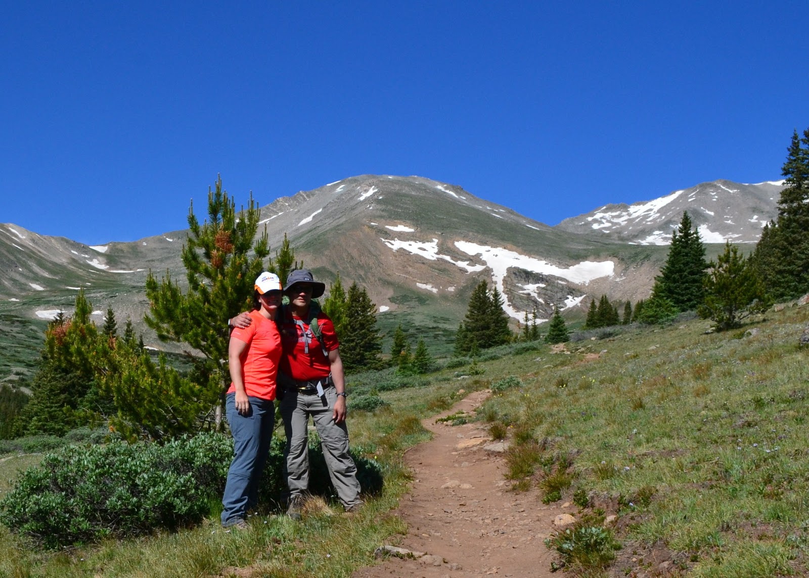
At the treeline, we stopped for a snack and took this photo. Still a long ways to go to the top.
We kept climbing and soon could see Leadville below us in the distance:
The weather was holding up and the skies were clear. As we got higher in elevation, it was getting a bit cooler. We had chatted with some hikers (and a few trail runners) who were already on their way down and they warned that it would be very windy in the saddle but that otherwise it wasn't too bad up top.
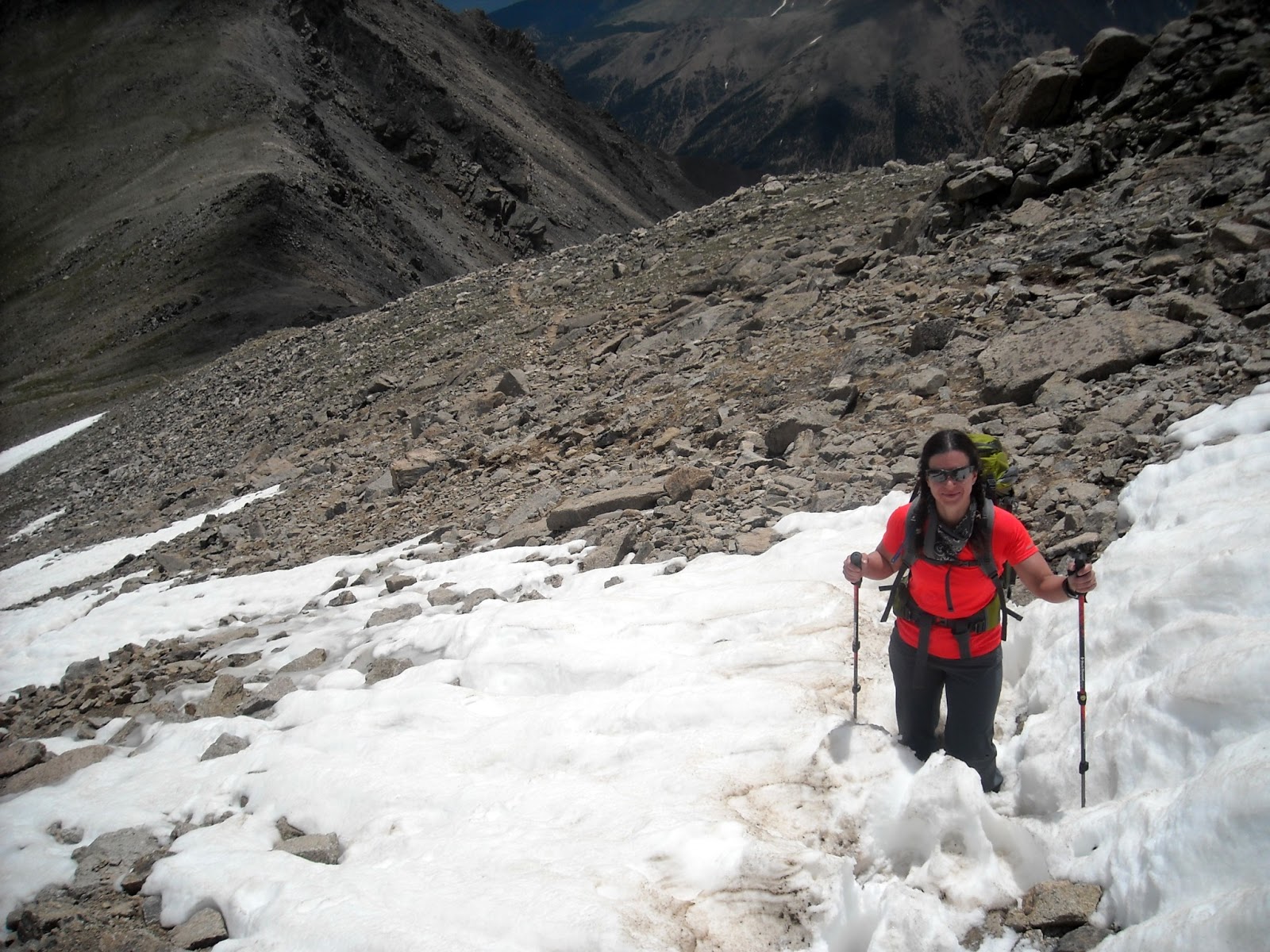
Sometime after 12,000 ft, our pace really slowed down. Rob dropped two of his water bottles off at this point to lighten up his pack. We marked the elevation and the interesting rock he stashed them at so we could pick them up on the way down. I held on to my overloaded liquid stash for another 670 ft in elevation change before I decided I had enough too. I picked a nice large boulder with a little carve out to stash a full gatorade, my two sports bottles and a half gatorade, also noting the elevation so I wouldn't miss them on the way down. Wow it felt good to be lighter!!
![]() |
| Can you tell where the trail goes? this wasn't it. |
| Garmin Elevation: 14000+ ft! |
We finally reached the summit. Though to be fair, it seemed like there are a couple of summits. The official one is where you sign the register. It had taken 6 hours to get to the top. There went my theory of being back to the car in under 8.5 hours!
We took a little bit of time at the top, taking pictures. The weather was perfectly clear and we weren't the last ones to the summit (we discovered later those that arrived after us had taken the shorter albeit steeper West slope route).
| On top of the world! |
| Rob at Mount Massive summit |
After hanging out a bit at the summit, the wind chill was getting cool and we donned long sleeves and started on our way down. Along the way we met some of the locals.... whatever these rodents are. they're kind of cute.
At 12, 670 ft I stopped to pick up my water bottles. Turns out those cute little rodents had chewed off the lid on my IMAZ sports bottle. I emptied out what was left in that, put everything back in my pack and we headed down.
Then suddenly, everything changed. The clouds off to the left got REALLY dark. and a giant lightning strike happened on the next mountain over. I may have been yelling at Rob to pick up the pace as we tried our best to make the treeline before the storm rolled over. Instead, we got pelted by hail. Not big hail, but a constant and steady shower of tiny pellets. I feared to look back into the hail so I kept track of where Rob was by calling out and he would check in. I was really getting the hang of those poles to move forward though! There are no pictures of this part of the adventure, we were way too focused on hauling butt down the side of the mountain than documenting evidence of the fantastic clouds, hail and thunder.
We finally made the treeline-- and the rain stopped. Of course. :)
Turns out the last few miles are not all downhill, but go up and down. I didn't remember this from our trip up. Although the change from trailhead to summit elevation is 4,000 feet, we had a total elevation gain over 6,000 ft.
I estimate that we had maybe an hour and half of stops, and the rest was in constant forward motion. My Garmin disagrees: it tells me that I was moving so damn slow that only 5.5 hours of "actual moving time" count, even though it's spot on for the distance covered. That's kind of depressing.
Total Time to complete hike, with time at summit and nutrition stops: 11 hours and 2 minutes.
| Ice bath for my tired feet after the hike |
Adventures at Enchanted Rock
While many of our crew were in Colorado, half of the Kili crew did a day trip to Enchanted Rock State Park. Enchanted Rock tips out at a whopping 1900'. Watch out. We packed our packs fairly full (mine was 20lbs) and took some of the rockier paths around the park. Lisa and I ended up making our own switchbacks up the rock to make ascending a little easier. We had to do the same on the way down as well. My knees were far from happy. Temps were a cool 108 that day so my assumed plan of going up and down a few times and a few times around the 4 mile loop were shortened...a lot. We did get in a little over 4 miles hiking with 1 or 2 trips to the top (superstars Jerry and Sreeni went for round 2 while Lisa, Mike, and I sat in the shade - foreshadowing of what is to come? We will see).
Afterwards we enjoyed an amazing lunch at The Brewery in downtown Fredericksburg - it was great food! We had a blast on our little day trip and considered it as much team building as it was training.
Sreeni, Jerry, Kathleen, Lisa, Mike
Training Trip: Leadville Heavy Half Marathon June 2013
Several of the Kilimanjaro group decided to register and complete the Leadville Heavy Half this year as altitude training trip. We weren't alone, some of our good friends who can't make it to Kilimanjaro this year joined us for the fun. The group at the starting line included: Vegas, Alisa, Catharine, Rhonda, Michelle, Rob, and Bekah.
Leadville is located at 10,200 feet and the "heavy half" (15.5 miles) climbs up to Mosquito Pass at 13,185 feet. This would be the second year of Leadville for Vegas, Michelle, Alisa, and Rhonda (?? fact check). Last year Vegas had a bad experience with the altitude and came prepared with Diamox. I was taking maybe two doses of 125mg the first day in Leadville. I had bought trail running shoes for the first time two days before at Luke's Locker in Austin, and this would be the first run in them. :)
When the race started, Rhonda jogged right past. Somehow she never looks like she is working. I kept her in sight for maybe the first mile but after that she was gone. At times, I couldn't see Rob or the girls behind me. Somewhere in that first mile on the nice open, easy footing road yet very much an incline, Michelle walked quickly by. I was taking turns walking and jogging already, and we weren't at the hard part. Rob caught up and we took a picture looking back over the mountains. Rob asked if I had given up on "racing" the event since I had been walking. I told him I was going whatever speed I could manage at any given point.
Eventually we reached a part of the road that started going down hill. This was a fantastic section to stretch the legs. Unfortunately, I also needed to make a pit stop. Rob passed at this point and I wouldn't see him again until he was coming down from the pass. Along the way I met a group of girls going the same speed - walking when necessary, jogging when possible. By 'group' I mean we all met each other right then, they didn't come together. One of the girls was from Ashville, NC (yay home state!) who was just visiting Colorado and had learned about the race at 5pm the day before and decided to sign up. She also camped for free out in the park. (side note: I really think camping around here would be awesome! great weather, there is actually water if you're packing in, and trees. but take bug spray). While we did exchange names, we took to calling each other "Hey Ashville" and "Austin, you've got this".
I think the last two miles were done at a 35 min per mile pace. It was getting hard to breathe, footing was a little precarious and our group was nice to move out of the cleaner lines of the trail for the 'real trail runners' who were hurtling themselves down the trail at top speed heading back to the finish line. about a tenth of a mile from the top I saw Rhonda and Michelle heading back down, and they reassured me the top was right around the corner. 20 seconds later Rob told me the same thing. That corner seemed like forever, but finally I reached the top.
I spent almost fifteen minutes at the top. Taking pictures, reapplying sunscreen, and just catching my breath. By the time I left, the group I had been with was way gone.
Leadville is located at 10,200 feet and the "heavy half" (15.5 miles) climbs up to Mosquito Pass at 13,185 feet. This would be the second year of Leadville for Vegas, Michelle, Alisa, and Rhonda (?? fact check). Last year Vegas had a bad experience with the altitude and came prepared with Diamox. I was taking maybe two doses of 125mg the first day in Leadville. I had bought trail running shoes for the first time two days before at Luke's Locker in Austin, and this would be the first run in them. :)
When the race started, Rhonda jogged right past. Somehow she never looks like she is working. I kept her in sight for maybe the first mile but after that she was gone. At times, I couldn't see Rob or the girls behind me. Somewhere in that first mile on the nice open, easy footing road yet very much an incline, Michelle walked quickly by. I was taking turns walking and jogging already, and we weren't at the hard part. Rob caught up and we took a picture looking back over the mountains. Rob asked if I had given up on "racing" the event since I had been walking. I told him I was going whatever speed I could manage at any given point.
Eventually we reached a part of the road that started going down hill. This was a fantastic section to stretch the legs. Unfortunately, I also needed to make a pit stop. Rob passed at this point and I wouldn't see him again until he was coming down from the pass. Along the way I met a group of girls going the same speed - walking when necessary, jogging when possible. By 'group' I mean we all met each other right then, they didn't come together. One of the girls was from Ashville, NC (yay home state!) who was just visiting Colorado and had learned about the race at 5pm the day before and decided to sign up. She also camped for free out in the park. (side note: I really think camping around here would be awesome! great weather, there is actually water if you're packing in, and trees. but take bug spray). While we did exchange names, we took to calling each other "Hey Ashville" and "Austin, you've got this".
| The Trail keeps going up and up and up |
| Looking back before we get to the "hard" part |
I think the last two miles were done at a 35 min per mile pace. It was getting hard to breathe, footing was a little precarious and our group was nice to move out of the cleaner lines of the trail for the 'real trail runners' who were hurtling themselves down the trail at top speed heading back to the finish line. about a tenth of a mile from the top I saw Rhonda and Michelle heading back down, and they reassured me the top was right around the corner. 20 seconds later Rob told me the same thing. That corner seemed like forever, but finally I reached the top.
I spent almost fifteen minutes at the top. Taking pictures, reapplying sunscreen, and just catching my breath. By the time I left, the group I had been with was way gone.
However, I suddenly felt AWESOME going down. I could breathe again, I wasn't having to climb stairs with every step, I could practically fly. I did have my friend Shannon's voice in my head though, reminding me to be careful and not twist an ankle or break anything by slipping on the rocks. It would turn out later when I looked at my Garmin that my suddenly "speedy" downhill miles were still at 18 min pace, but when compared to 35 minutes, it's a huge improvement. I was really happy to see Vegas and Catharine on the way up, they were sooooo close to the top. Somehow I missed seeing Alisa :( but we were both watching our footing and passed without knowing it.
EVERYONE MADE IT ALL THE WAY TO 13,185 FT!!!!
The last couple of miles into town were straight down hill on level gravel road and it was possible to finally "run". My running pace at the point was 9:30s. I had trashed my glutes going up and in the next two days I would learn how badly I trashed my quads on this downhill. I caught up to and passed Ashville and the BadAss compression socks girl, and several other runners who had passed me earlier in the day. I was having such a great time coming down the hill that I took a wrong turn when I reached town. In all fairness the white chalked line looked like a normal painted "stop" line for cars! Luckily BasAss compression socks started shouting at me and I figured out my mistake and came back to the course. Finish time: 4 hours 46 minutes for my officially slowest half marathon ever (previous: Las Vegas RnR Half walking, gambling and imbibing race in Dec 12 with a time of 3 hours 40 min)
I think I told someone that this event was harder than Ironman. The elevation is definitely a killer, and I recommend more trail running experience, but it was definitely worth it. Soooo happy I came out for this!
Thursday, June 20, 2013
Hiker Introduction: Bekah D
Nicknames?
2. Previous hiking experience
My dad and I used to hike up Chimney Top in North Carolina the summers I was in middle school. It was switchbacks and single track the whole way up, and at the top we'd enjoy some canteen water, crackers, and some of that Cracker Barrel square cheese logs that seemed so cute.... sliced with a pocket knife. Other than that, there was a portion of a crazy adventure race I did in 2009 that was somewhere between hiking and trail running -- all in the dark for the part on foot. I've recently become reacquainted with the fact that trail running is nowhere close to road running and that all my 'training' can seem irrelevant when faced with 20 miles of rocky trails. :)
3. What made you want to go on this trip?
Adventure? With awesome inspiring wonderful people? yes. I've wanted to go since we started talking about it, though for a couple months I did back out due to fear of economic irresponsibility. I got my priorities straight though -- this is a once in a lifetime trip and I am so happy to be surrounded by fearless adventurous friends. Finally--there is way more to life than Ironman and work and I really want to experience it all!
4. What legs of the trip are you going on?
The Climb, the Safari and a couple days on Zanzibar island!
5. What words/phrase do you think you will slightly overuse on the trip?
"wow" (as in Wow, that is beautiful, Wow it is freaking cold, wow this food is "interesting"). That is assuming I can form any words apart from whimpering from an altitude induced headache. :)
6. What is your greatest fear leading into the climb?
Now Kathleen has me worried about peeing. great! I hadn't thought about that before this. I guess related to that is freezing off my buttocks while trying to pee. Cold is definitely my greatest fear.
7. What are you most looking forward to after the climb?
Flushing toilets (that the paper goes into versus a separate bucket), a real bathtub, and free refills of drinks at restaurants.
8. What is going to be your "special phrase" for "the altitude is killing me and you all better leave me alone or else..."?
I miss Java.
9. Anything else we should know about you?
I'm excited and terrified all at once. I've never been to Africa (My mom has done a few missions there) so I'm really happy to have the opportunity to see a new part of the world and meet some amazing people. I'm looking forward to coming back with fresh perspective and joy for life.
Tuesday, June 11, 2013
Hiker Introduction: Kathleen
1. Nicknames?
The list is very long...Pink Bunny, Pinkalicious, Woody, Woodrow, Arms, Ox, Compton, Kat, Pinky Tuscadero (Pinky for short), Woody Jr, Velvet (from 7th grade Mathcounts...don't ask), the rest aren't necessarily PG-rated
2. Previous hiking experience
Not much. When I was 16 I went on a backpacking trip with my summer camp (Camp Olympia - best ever!) in Colorado. We just spent one night on the mountain just below the tree line and hiked to 13 something thousand feet. We did have to carry tents, food, sleeping gear, etc, so the packs were 35-40lbs a piece which is more than we'll have in Kili, but it was a good 6000' short of how high we are climbing...and a few (7) nights shorter as well! Last year my friend Kim and I hiked Mt. Quandry just south of Breckenridge which is 14,285. It was about a 5 hour round trip, so still pretty hard to get any real comparison there. I wasn't a happy camper for the last hour or so we were going up and needed the phrase mentioned in #8 below on more than one occasion.
3. What made you want to go on this trip?
The idea that I don't have to shower for a week? Or that I started planning my candy packing list as soon as I committed? Or perhaps really because I had nothing better to do and this sounded like a great way to continue my "retirement" from Ironman triathlons with a great group of friends.
4. What legs of the trip are you going on?
I'm heading on the 3 day safari in Tanzania after the climb and then another 3 days on the small island of Zanzibar - it looks heavenly!
5. What words/phrase do you think you will slightly overuse on the trip?
There will definitely be one too many f-bombs thrown down on my part as well as "really?!?," "are you kidding me?!?," and various forms of "uuuuuuuuuuugggggggggghhhhhhhhhhhh."
6. What is your greatest fear leading into the climb?
The number of times I'm going to have to pee on a daily basis. No lie. I drink tons of water as it is and we are supposed to drink even more on the hike. And the drug we take for altitude is a diuretic. Really? I haven't wrapped my head around peeing on the side of a mountain where the temps are below freezing...over and over and over again.
7. What are you most looking forward to after the climb?
Most likely a real bed and food of my choosing. And flip flops.
8. What is going to be your "special phrase" for "the altitude is killing me and you all better leave me alone or else..."?
Cupcakes
9. Anything else we should know about you?
I like candy. And naps.
Subscribe to:
Posts (Atom)