Tuesday, August 6, 2013

Bekah's Gear List for Kilimanjaro


The preparation for this trip has been eye opening. I feel like I should be on a first name basis with most of the staff at REI by now.   Fortunately, my most expensive pieces of gear were acquired during the annual sale.

Kilimanjaro Hiking Gear: 

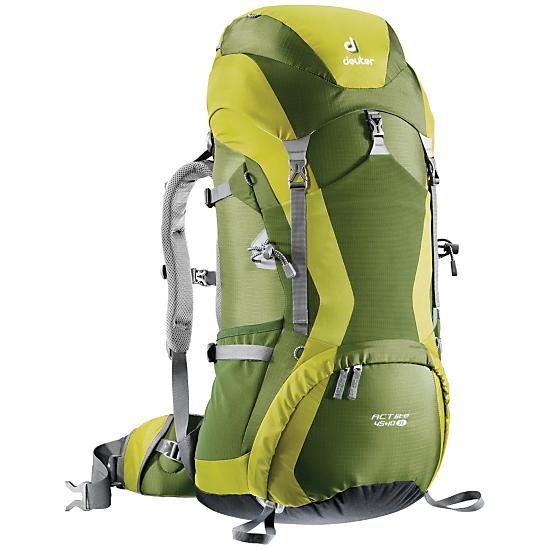
BackPack: Deuter Womens' air contact pack, Acquired during REI Sale with Member 20% coupon.  45 L.   Since we have porters carrying the majority of our necessities for the climb,  we really just need a daypack for snacks, our water for the day and any extras (like cameras) we want access to during that day's hike.  It is possible to get away with a regular school type backpack but eventually the straps will cut into your shoulders (especially for women with sports bra straps underneath), and I'd like to go backpacking again in the future and so this was an investment.

This pack is very comfortable after trying it out in Colorado on two 14ers and some day hikes in Austin on the greenbelt.


North Face BaseCamp XL Duffel:   This is the bag that will be checked on our flights over and that will have the stuff the porters carry up the mountain.   The XL seems to be the correct size for a trip this long. It has straps that can be used as a backpack and overall appears much easier to handle than the military style duffel bag I have from REI.  (I may still use the REI bag for donations to take to Africa)


Sleeping Pad:   We are renting sleeping bags there as there is no reason for Texans to own a $300+ sleeping bag rated for very cold temperatures. We would never get to use it here in Texas.  The outfitter did recommend bringing a more comfortable sleeping pad -- the porters will bring a thin foam mat but that is it.  I went with the Big Agnes Q-Cor insulated inflatable sleeping pad (everything is going to be cold, I  think I will enjoy some insulation. ).  Acquired this during the REI Sale.  I have since unpacked it and inflated it to test at home and realized that the probability of me being able to manually inflate it at elevation is unlikely-- all that cushiony goodness comes at a price.  Thankfully,  Big Agnes makes a "pumphouse" -- a dry bag that can be used to inflate the sleeping pad and then when stuffed with some clothes doubles as a pillow and weighs nothing.  I'll be acquiring one of those soon.

Base Layers:  I have tons of tech tees from races and these will be my base layer under my top.  I picked up a pair of long underwear bottoms and some sock liners.

Convertible Pants--  I've got a couple pairs of Mountain Hardwear convertible pants.  The fit on these is far better for me than the equivalent Columbia or REI brand pants.  Hopefully by packing convertible pants, I have to pack fewer articles of clothing.

Existing outerwear:  I have a North Face 3in1 ski jacket  and some inexpensive ski pants I'm bringing for summit day.  I also already have heavy gloves and glove liners.  I did pick up some hand warmers from REI.

Water Purification:   The porters will be boiling our water for safety,  but it's recommended we take a backup option.  I've opted for the CamelBak  AllClear water bottle purifier. It's a .75L water bottle (quite similar to a nalgeen bottle ) that comes with two lids -- one is a stand cap and the other one contains a UV light that kills the stuff in water.   It seems the most compact option and less work (there are other purifiers you have to pump water through by hand,  and iodine tablets take 30 minutes but this is done in 60 seconds).

Headlamp for Summit Day. also useful for trail running

Hiking Boots.  The purple laces stand out,  but they're waterproof and comfy so far.

Goal Zero Guide 10 Solar Charger  (reviewed separately).

Existing  Camelbak water bladder -- but got a new insulated tube  (partially in an attempt to prevent it from freezing on summit day,  but mostly because it is near impossible to completely clean the tube and it's time for a new one).


Safari Gear:

Sun Hat, REI brand.


Zanzibar: 

nothing so far.  


Gear Review: Solar Charging Kits


The closer we get to our trip, the more gear we have amassed to either "survive", or at least be more comfortable.

Under the "more comfortable" category,  several of the team have purchased solar charging panels.  While none of us expect to be making phone calls or updating Facebook from the top of Kilimanjaro,  there aren't any power options to charge camera batteries, headlamps, kindles,  or water purification bottle batteries. You'd think we could survive a week and half without electronics, but I think our society as a whole has forgotten how.... and now we don't have to.

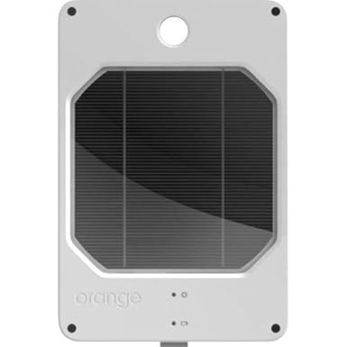
So far Vegas and Kathleen have chosen the Joos Orange Solar charger ($153 Amazon):

This is an all in one tablet sized panel with a hard plastic casing that appears to be very rugged!  It has a loop hole at the top for hanging from your pack to charge as you walk around.   It also claims to keep charging when submerged.  Vegas and Kathleen have been testing it out on this past weekend's hikes in the greenbelt.  One thing to note is that it has one attachment point- the top. If you stop and pick something up off the ground make sure it doesn't flip over and bonk you on the head!

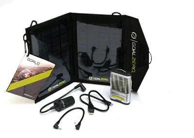
Sreeni and I both opted for a different model:  the Goal Zero Guide 10 Plus  kit ($105 Amazon).    Both kits weigh approximately 1.5 lbs (for the Goal Zero, that includes the battery pack).  The Goal Zero panels fold up like a book when not in use,  and the back side has a mesh pocket for storing the battery pack and cables. There are multiple loops for attaching at multiple points. I'm using small s carabiner hooks to attach it to my pack.
Unlike the JOOS Orange,  the Goal Zero is not waterproof.  I mean, it will be fine in light rain (assuming you are still getting enough sun to charge,  but you can't use it in a pool like the JOOS pictures indicate).  It does not have an integrated battery in the panels,  if you are trying to catch sun with the panels then you either need to have the battery pack connected to store the charge or you need to connect the device (such as a phone) that you want to charge.  You can use the battery pack separate from the panels to charge one device while charging another from the solar panel.  

iPADs-- the JOOS will charge an iPad directly though I do not know how long that takes.   With the Goal Zero,  you can charge from the battery pack or use the battery pack as a conduit to the solar panels.

At home, I've connected the solar panel to a smartphone and immediately upon placing it in full sun, the device began charging. I can put the device in the mesh pocket (under the solar panel) to minimize how hot it gets in the sun.

Battery pack takes rechargeable AA or AAA batteries (must use 4 at a time),  so you can bring extra batteries to keep charging when the first set completes if you are using AA or AAA batteries in devices like cameras or headlamps. Unfortunately, my cameras take proprietary batteries so I need to charge them via USB from the pack or from the solar panels.   It is possible to buy a second battery pack so you could swap them out to store charges if you wanted, but I have not purchased one  ($35-$40, Amazon)

Pros:  a little cheaper,  can charge with both battery pack and solar panels simultaneously,  lightweight,  seems durable, multiple connection loops for securing to pack,  mesh pocket organization keeps cords handy.
Cons:  not as rugged at the JOOS Orange, no integrated battery,  does not charge iPads directly from solar panel,  not "waterproof".

Monday, August 5, 2013

Hiker Introduction: Rob


1.  Nicknames?

Glob is my gaming screen name.  Not going to give anybody any other ideas.

2.  Previous hiking experience

Not much.  When I was 17, I did a hiking/canoe trip with a church group to the Boundary waters ( The lakes between Minnesota and Ontario).  We had to haul either a 60lbs backpack or a 80lbs canoe between lakes.  Some of the portages where over a mile long.

The things I remember about the trip are:

  *  Lots of mosquitoes.

  *  Missing the Moose.  We were paddling so hard to keep up that we didn't see the moose that was 100ft away.

  *  Falling asleep while tending the fire.  Since this was a trip affiliated with a church, every one in the group was supposed to take turns tending the fire at night to reflect.  When It was my turn, I had other plans.  I dragged my sleeping back and fell asleep at the fire. The next morning they found me asleep by the fire pit and the fire was out.

3.  What made you want to go on this trip?


 *  Done the Ironman/triathlon thing.  Want to try something different.

 *  The Kilimanjaro trek will be challenging, a little scary and will push my limits. 

 *  Being around 6 beautiful single women sounded like a good idea.


4.  What legs of the trip are you going on?

    *  Kilimanjaro (8 day Lemosho trek)

    *  Safari ( Lake Manyara, Ngorongoro Crater, and Tarangire)

    *  Zanzibar


5.  What words/phrase do you think you will slightly overuse on the trip?

  *  I have a headache.  Because of the altitude on the climb, I think people are going to be saying this a lot.

  *  HAFE  (The non-serious altitude sickness)
    
  *  It's all good.


6.  What is your greatest fear leading into the climb?

  *  That I won't make it to the top. 

  *  That I will get sick.

  *  My luggage will get lost.

  *  Miss the connection in Amsterdam.

  *  Recently the Terror Warnings.


  *  Watched "Touching the Void" a while ago.  It is a movie that shows what can go wrong in mountaineering.  Even though it doesn't really apply to this climb, it keeps coming to my mind.   The movie is more about hard decisions and the need to keep pushing.

http://www.imdb.com/title/tt0379557/

7.  What are you most looking forward to after the climb?

After 7 days without a shower, so it has to be a shower.

8.  What is going to be your "special phrase" for "the altitude is killing me and you all better leave me alone or else..."?

When hiking with Bekah in Colorado, she would kiddingly hint that she want to "push me off of the mountain."  I reminded her that if she pushed me off a cliff that she would have to go down the mountain, find my body, and get the car keys.

9.  Anything else we should know about you?

A year ago I had a lot of concerns about the trip.  Mountain climbing can be dangerous.  There are all kinds of things that can occur.  One is altitude sickness. 

HAPE - High altitude pulmonary edema.
HACE - High altitude cerebral edema.
HARH - High altitude retinal hemorrhage

When I was in for an eye exam, I asked the eye doctor about HARH.  Instead of talking about HARH the doctor said.   I was watching PBS a few days ago and a guy with no arms and no legs climbed Kilimanjaro.  What the doctor was really trying to say but couldn't was;  There are risks, but go climb the mountain.

http://www.youtube.com/watch?v=LuH4sK25AwE

Weather Forecast....colder than planned

We just found a link to weather at various places on the mountain.  I guess the good? news is that the weather on the summit isn't any worse than we were expecting...but I guess that isn't hard to do when we were basically expecting the worst!  The surprise is that the first few days are colder than any of us were thinking.  Looks like we start the trek in weather around 60F near 7800' and then it drops to the 40s for our first night at 9500'....and just gets colder from there.

Link is here:
http://www.mountain-forecast.com/peaks/Mount-Kilimanjaro/forecasts/5963

Click the little buttons on the left near the date to go between "metric" (elevation in meters and temperature in Celsius) and "imperial" (elevation in feet and temperature in Fahrenheit).

Friday, August 2, 2013

Vaccinations/Medications

Several of us visited the travel clinic at Austin Diagnostic Clinic (ADC) for our vaccinations and medications and so far I think we have all been fairly pleased.  Here is a rundown of what most of us got:

Vaccines
1.  Hepatitis A/B combined vaccine - this is a three injection series with the second injection 4 weeks after the first and the third is 5 months later.  This is a good reason to get in at least 6 months before you travel for your first round of vaccines.  Cost was $135 for each round.  You are covered for 30 years for Hep A and a lifetime for Hep B after receiving the full round (3 injections).

2.  Tdap - Tetanus diphtheria and pertussis.  The pertussis part is a fairly new addition to the vaccine and strongly recommended.  I had my last tetanus in 2010 and they said if I didn't know for sure if I had pertussis included that I needed to get the whole shebang again.  Whohoo.  None of the injections hurt while receiving them, but this one makes your shoulder hurt for days afterward.  One rounded needed, $70.  Td (without pertussis) booster is recommended after 10 years.

3.  Typhoid - I chose the oral vaccination (4 days of pills if I remember correctly).  Also had the option of injection.  Oral lasts 5 years, injection lasts 2 years, both cost $80.

4.  Polio - one injection recommended.  Lasts a lifetime, cost: $45.

5.  Yellow Fever - the big question mark.  Per current CDC guidelines, yellow fever is not required to travel to Tanzania from the US (assuming you don't stop in some random places for too long on the way there).  However, there are rumors abound that the first thing they ask you for in customs is your yellow fever card.  If you don't have it, you are taken to a different place - if you have it, you continue on through customs.  No one has necessarily verified what happens in that "other place" but it is presumed you are made to get the shot there on premises.  Most of our group has elected to get the vaccine to avoid any potential issues in the airport and none of us is interested in receiving an injection of any type in Africa.  The vaccine lasts 10 years.  I'm unsure of the cost as I'm getting it next week.

Drugs
1. Malaria drugs.  There are four types we received info on from ADC.  All had various use guidelines and side effects.  It is best to discuss with your medical provider which will be best for you.  I went with generic Malarone.  It was still $165 for a 26 day course.  Awesome.  You begin taking it 1-2 days before entering the region and continue through 7 days after leaving the region.

2.  Antibiotic.  I got generic Zithromax; 2 tablets as one dose to take for traveler's diarrhea if necessary.  Received 4 tablets total.  Cost $20

3.  Diamox.  I do not have the specifics on this yet as I haven't gotten my rx for it but will next week.  This drug is used for altitude.  Some people don't take it until they need it, others take it throughout the climb as "insurance."  It isn't guaranteed to work - some say it works wonders and others do not notice anything.  The #1 side effect is going to be a huge nuisance: it is a diuretic.  Awesome.  I get to pee on the side of a mountain in 10 degree weather even more often now.

Other Drugs
1.  Ambien - I did my research and found out ambien is okay for taking at altitude - hallelujah!  If I don't sleep, this whole trip will go to hell in a handbag quickly.  Apparently the camp sites can be very noisy, not to mention uncomfortable.  I have also read there are monkeys who like to jump from tent to tent at night on one of the early nights - awesome.

2.  Asthma drugs (symbicort and albuterol) - I forget I have asthma most of the time, and usually by the time I remember it is too late to do a lot for immediate relief.  However I plan to bring both drugs with me and will use as needed.  Both have been indicated as potentially beneficial/helpful at altitude.

3.  OTC drugs: immodium, pepto, advil (see first aid kit post for more listed)

4.  Supplements/Herbal remedies: Ginger has been touted as a great thing to have to combat nausea that is almost inevitable from a host of issues while climbing.  Several of the group have been trying out beet juice supplements as well and they are supposed to help with altitude.

Please leave a comment if you have anything else to add!!

UPDATE:  I was fairly pleased with ADC until it came to the rx for Diamox.  The literature they give you recommends 125mg twice a day starting 24 hours before entering altitude (7000' according to them) and continuing for 24-48 hours after reaching the highest point.  So that would mean I'd take the drug for at least 8 days.  Twice a day = 16 pills.  They gave me 7.  Seriously?  And they would not budge.  So, plan ahead and know you will have to get this from your regular dr if your travel clinic is anything like ours was.

Good Videos to Watch

I had hopes of updating my own blog as this process went along to create a guide of sorts for others who may be interested in climbing Kilimanjaro.  I haven't done a very good job of that but thought I would at least post a few good bits of information that have come about from our almost two years of discussion and research on the trip.

Rob sent us all these videos and they are a great account of what the trip can be like:


Red Nose climb

Part 1
https://www.youtube.com/watch?v=cOgxZnSbn2Y

Part 2
https://www.youtube.com/watch?v=ihuIJr_uqB8

Part 3
https://www.youtube.com/watch?v=tbCCUQ6LIJM

Part 4
https://www.youtube.com/watch?v=RynaPh7CLTc

Part 5
https://www.youtube.com/watch?v=uFvIcBsL4QM

Part 6
https://www.youtube.com/watch?v=VQJT0tlpijY

Part 7
https://www.youtube.com/watch?v=HMrpRjtxhR0

Monday, July 8, 2013

Saturday, July 6, 2013

Hiker Introduction: Mike


1. Nicknames?

These are a handful of names that I have answered to over the years, some more flattering than others:  Lil Mike, Mikey, Larth, Weasel, Jabberwocky, Mutton Chop Evil, Pancho Villa, Tank, Captain Sack and Colonel Mustard to name a few.

2.  Previous hiking experience:

Was this a prerequisite??  I didn't think you needed hiking experience to climb Kili, if so, Im screwed.  Is it to late for a refund?  In all honesty, I had zero hiking experience prior to signing up for this adventure.  Over the past few months, I have hiked the Greenbelt in Austin, climbed 2k feet to the top of Enchanted Rock (watch out) and walked countless laps around Memorial Park with my back pack and hiking boots, often being confused for a homeless person.  In July I am traveling to Colorado to climb Mount Massive and Mount Elbert, so that will be a huge test prior to heading to Tanzania.  

3.  What made you want to go on this trip?

Lions, zebras, giraffes, rhinos, leopards and elephants.  Need I say more?  I cant wait to see these animals in their natural habitat, its going to be awesome.  I'm a little excited for the safari.

4.  What legs of the trip are you going on?

Attempting to climb Kili, the African Safari & wrapping up the trip spending a few days on Zanzibar.

5.  What words/phrase do you think you will slightly overuse on the trip?

I think these will cover the entire trip:

  • Are we there yet? How much further? 
  • Sounds great, but Im going to need to take a break before we do that.  
  • Are you sure this is edible?
  • I just want to see a lion!!!!

6.  What is your greatest fear leading into the climb?

If flying half way around the world to climb a mountain and freeze my rear off isn't enough, its probably being eaten by said lion in question #5.  Either that or being bitten by some snake/insect/mosquito that was not part of the 20 shots I had to get to go on this vacation.

7.  What are you most looking forward to after the climb?

Laying in a hammock in the shade with an iced cold beer.  A close second is the ground beneath my feet being level.

8.  What is going to be your "special phrase" for "the altitude is killing me and you all better leave me alone or else..."?

One of two options:
"Dude there?" or "Buddy!!!!!"

9.  Anything else we should know about you?

My vote will always be to slow down!


Mount Quandary or is it Mount Quandry?


Mount Quandary,  Mount Quandry.  I've seen it both ways and I'm still not sure which is correct!

Originally  we had planned on hiking the shorter Mount Quandary route on July 3, and then tackling the longer Mount Massive route on Independence Day.  After checking the weather,  the fourth had more chance of rain and Rob's priority was Mount Massive so we hiked that first and rescheduled Mount Q for the following day.
After surviving the 11 hours on Mount Massive and all of the excitement of getting caught in a storm, we managed to get dinner and the negotiations about hiking Quandary in the morning began. Rob didn't think we'd get enough sleep because it was already late and we'd be getting up early. I argued that we wouldn't need to start as early because it was a shorter hike,  and that we could always set the alarm and make a game time decision in the morning.  Rob agreed and reiterated that he was pleased with finishing Massive and Quandary would be a nice-to-have but not mandatory.

Rob takes a bit more time to get ready in the morning so he arranged for another wake up call from the hotel. I admit, I silently groaned a bit when the phone rang.  20 minutes later my phone alarm went off and it was time to get up and make a decision.  We discussed forgoing the Quandary hike and going to Garden of the Gods instead but soon realized that we'd be spending most of the day in the car getting to and from Garden of the Gods and we'd rather spend that time hiking.  I repacked my pack-- a little less water and less weight this time, but still heavy with the camera and the water I did carry.  Off we went to summit our second 14er in as many days.

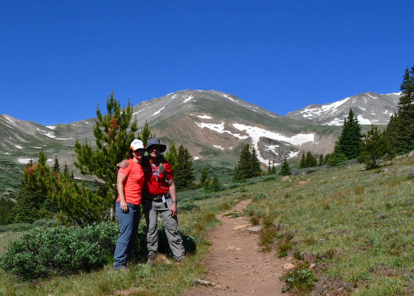
Mount Massive had been rated a "2" on the difficulty scale,  and Mount Quandary was rated a "1" despite achieving the same elevation change in about half the distance.  If you look up the difficulty ratings,  a "1" is supposed to be walk up trail on level ground.  Obviously when you're climbing 4,000 feet in 3.5 miles, it's not level in the sense that you're on flat ground, but I'd assume the trail was well groomed with a lot of switchbacks.   Indeed, the beginning of the trail looked like this:


I had estimated it would take us 4 hours to reach the top and two hours to get down.  More time to get up because of how hard it gets to breathe climbing that fast in a short time and needing to take breaks, but must faster coming down because the extra oxygen would feel great and those groomed trails would be easy to navigate without worrying about falling. 

So far, so good!  I actually felt pretty good given the previous day's hike and ready to tackle this mountain!

The terrain soon changed and started to get more rocky. 


You can see from this picture all of the people on top of the ridge. No, that's not the top of the mountain. It's not even close


Once we reached the ridge, it became very clear that there was *nowhere* a girl could answer the call of nature without flashing everyone on the mountain.  And this was a popular hike with full vantage both up and down trail.  :(

The trail kept getting rockier and rockier.  In fact, there was no trail to speak of,  at least not by any definition I know.  Occasionally there were large man made piles of rocks sticking out of all the other jumbles of rocks, and these let you know you were mostly heading in the right direction.  On either side of you, if you went too far there were steep slides into oblivion that were definitely not where you wanted to go. 


We joked with another hiker who was descending that this climb is like one of those "Choose your own Adventure" books where you pick a path and go to page 92 to continue on with your hike.   We were also starting to see a lot of the same people… a group of three couples in their early 20s who would leap frog us,  then rest for 10 minutes and then leapfrog us again,  and "old navy sweatshirt" guy  who actually wasn't there alone but sure seemed to be.

Somewhere between 13,000 and 13,400 feet I suddenly started having a really really difficult time.  I threatened to drop my pack and come back for it,  surely without all the weight I'd be as nimble as a mountain goat bounding up these rocks.  Rob talked me out of it and convinced me that mountain rodents would eat holes in my pack if I left it. He offered to take two water bottles from me,  so that helped.   Maybe another 200 feet up,  he took the camera as well.  It was maybe five minutes before he told me that wow, the camera is heavy.   I'm not sure if it was the steeper climb today or just the cumulative effect of the week's activities and the hike the day before, but I continued to struggle up the slope and rested a lot.  I should have taken another Diamox,  as I had only been taking 125mg once per day after Leadville,  but I didn't.  Rob stopped and brought out his pulse-oximeter which somehow measures the oxygenization percentage of your blood. His measurement was 99%.  Mine was 70%!  This is not a good number. 

The closer we got to the top,  the less sure I was about wanting to get to the top.  I felt much worse than at Mount Massive,  this was supposed to be fun,  and I was getting extremely concerned about coming down without slipping or twisting an ankle. However, no one in our group ever quits so pressing on!  

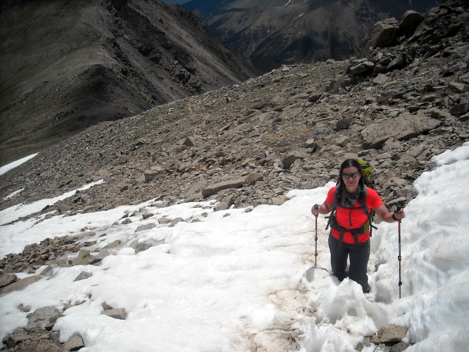
Right before the summit, hikers have to cross an area of snow which is quite slick.  Mostly we tried to stay in the footprints of previous hikers but I watched a couple of people descending who were sliding on the slush.  

Finally we were at the top!!! Including the extra quarter mile from the parking lot to the trailhead, we were under 3 hours and 50 minutes so my estimates had finally been right.   What a great view. 


Proof: It's Quandary.  But the tshirts say Quandry! 


We spent 17 minutes at the top and I felt normal again. Time to descend over all that rock: 


On the way down I used only one hiking pole, as I find with two poles I'm always trying to figure out where to put them and then losing my balance over the rocks.  We had to be careful because the poles could get stuck between the rocks which might cause them to break.  I descended much faster, hopping from rock to rock along the ridge the best I could given I was in hiking boots and carrying a pack.  Rob took a more conservative approach and used both poles and descended at a safer speed.  

We had seen some goats from afar during the trip up, but on the way down we got up and close and personal with them.   They're BIG.   You don't want one of them pushing you or you will definitely go flying off the mountain!


Unlike Mount Massive,  there were no storms today.  Instead, the lack of shade became an issue as the sun beat down on us. I reapplied sunscreen twice on the way down.   Remember how a girl shouldn't flash the entire mountain?  Part of my hurry to get down was to find a nice tree.  Unfortunately, the first concealed tree group I found, the group of 20-somethings decided to stop RIGHT THERE on the trail and have a snack.  I've been holding for 3 or 4 hours now, but on we go. I lose sight of Rob for a bit behind me but I'm on a mission. I'm stopping to check every once in a while.  Old Navy sweatshirt guy passes me.  then the 20somethings catch back up. And the boys pick the next tree grove (only the second one available since the summit) for their own business and I wait impatiently for them to go on down the trail.  That group of trees was very well watered and popular from what I saw. 

Rob caught up at this point and also thought it was a very nice set of trees and then it was onward down the trail.  Finally made it back under the shade which felt amazing!!!!  It had taken us just over 3 hours coming down,  not nearly the time difference I expected between up (against elevation changes and going up) versus down (easier breathing,  but still having to pick my way through uneven terrain and slippery rocks).  

Total time:  7 hours 12 min  from parking lot to top,  taking pictures at top,  back to parking lot. 
Calories Burned:  My garmin thinks only 1800, but it also thinks I was only moving for 3 hours and 11 minutes! I guess when you move so slow and you're moving up rather than forward, it has a hard time figuring out that you're not just sitting on your butt.   I think I burned about 2500.  
Calories Consumed:  475  (one payday ,  half of a Pro Bar, 20oz Gatorade G2,  and some water). 

This time my legs were screaming from the abuse,  so we found a nice stream for an ice bath! Rob declined to participate in sitting in snow runoff temperature waters.   


That's it!  two 14ers in two days,  all in the same week as Leadville Heavy Half trail run.  I've learned that while I don't get sick, and I don't necessarily get a bad headache,  I am definitely affected by altitude but I'm okay if I get to level out.   Staying on top of the diamox meds in Kili is mandatory for me. 

Friday, July 5, 2013

The First Aid Kit

Details, details....

I spent my Friday night putting together our group's first aid kit and watching "Say Yes to the Dress" - I know how to have fun.


So far, this is what we have in the kit:


Ibuprofen - ~100
Tums - 3 travel size rolls
Zyrtec - 15 pills
Chewable pepto - 36
Sterile needles/syringes - 4
Acetaminophen - 20 tabs
Hydrocodon - 18 (Rx with Tylenol)
Tegaderm bandages - 2
Nextcare large waterproof bandages - 3
Large nonstick dressing - 2
Sterile gauze pad - 4
Anti itch cream
Antibiotic cream
Wound cleaner
Small duct tape
Paper tape
Alcohol swabs - 12
Scissors
Benadryl - 12
Nauzene (for nausea) - 20
Assorted blister band aids (multiple day use) - ~18
Regular band aids - small spots to large bandages - lots
Coldeze cough drops - 15
Tweezers
Nail clippers
Nail file


I'm hoping we don't even need 10% of what I'm planning to bring, but I'm sure if there is something we don't bring, we will inevitably need it.


Training Preparation: Rob and Bekah hike Mount Massive Jul 3, 2013


Rob and Bekah extended the Colorado trip past the Leadville Heavy Half trail run for some training hikes up a couple of the 14'ers.  "14'ers" are the name for summits above 14,000 ft elevation...  and apparently people "collect" hiking all of them. There's a checklist and everything at http://www.14ers.com/routes_check1.html.   

Mount Massive was the top of the list for us to hike.  It's the second highest in the area -- Mount Elbert wins the title of tallest by 12 measly feet.  On the difficulty scale, Massive is ranked as a "2".  With a 14 mile roundtrip and 4,000 feet elevation gain,  you'd think that elevation gain would be fairly spread out.  It was a nasty surprise to learn that the last 2,000 feet are covered in the last mile and half or so.... 

I should have paid closer attention to this profile before hiking

I had learned my lesson from the trail run at Leadville--  this was going to be a slow day.  At Leadville we had climbed 3,000 feet and the trip was 15.5 miles roundtrip.  Factoring in  "Kili prep"  of hiking boots and loaded backpack,  I estimated it would take 8 hours, maybe 8.5 to do this hike roundtrip.  I was wrong. so very, very wrong.

At the trailhead, ready to tackle our first 14er!
Rob had read somewhere that we needed to take 3.5-4L of water with us.  That's a lot of water. and a LOT of weight.  But, this was a training hike and it would really suck to run out of water, so I loaded up my 72 oz camelbak bladder,  grabbed three gatorades and two sports water bottles.  Also, I was carrying my DSLR camera and extra lens.  I didn't want to hike to the top and only have phone pics.


poles help crossing streams
The first part of the trail wound through the woods and over a couple of streams. We were definitely going up, but it was very manageable and enjoyable.  The cool air, beautiful forest were very soothing. It was my first time using my hiking poles and I was getting used to using them for balance.

This part of the trail was right on plan. we were averaging over 2 mph,  which is what I expected with packs.


One of my primary roles on this trip was "safety buddy" since anything can happen out on a hike like this. My inner AustinFit coach made an appearance as I reminded myself and Rob to hydrate and to eat.  While we're just walking, the duration of the hike means you do need to be taking in some nutrition.

At the treeline, we stopped for a snack and took this photo.    Still a long ways to go to the top.


We kept climbing and soon could see Leadville below us in the distance:


The weather was holding up and the skies were clear. As we got higher in elevation, it was getting a bit cooler. We had chatted with some hikers (and a few trail runners) who were already on their way down and they warned that it would be very windy in the saddle but that otherwise it wasn't too bad up top.


Sometime after 12,000 ft, our pace really slowed down. Rob dropped two of his water bottles off at this point to lighten up his pack. We marked the elevation and the interesting rock he stashed them at so we could pick them up on the way down.  I held on to my overloaded liquid stash for another 670 ft in elevation change before I decided I had enough too.  I picked a nice large boulder with a little carve out to stash a full gatorade, my two sports bottles and a half gatorade,  also noting the elevation so I wouldn't miss them on the way down. Wow it felt good to be lighter!!  

Can you tell where the trail goes? this wasn't it.
 Then we were starting the real climb up to the peak. The closer we got to the top, the harder to distinguish the trail. We saw footprints and a path through the snow on one side so we followed that. Turns out that wasn't part of the trail.

Garmin Elevation: 14000+ ft! 
We finally reached the summit. Though to be fair, it seemed like there are a couple of summits. The official one is where you sign the register.  It had taken 6 hours to get to the top.  There went my theory of being back to the car in under 8.5 hours! 

We took a little bit of time at the top,  taking pictures. The weather was perfectly clear and we weren't the last ones to the summit  (we discovered later those that arrived after us had taken the shorter albeit steeper West slope route).  
On top of the world!

Rob at Mount Massive summit

After hanging out a bit at the summit, the wind chill was getting cool and we donned long sleeves and started on our way down. 


Along the way we met some of the locals.... whatever these rodents are.  they're kind of cute.


Right after we descended from the saddle, it really started getting cold and we stopped to get out our winter coats.  There were a few snowflakes but nothing serious yet.  We could see a storm forming off in the mountains on the left side.

At 12, 670 ft I stopped to pick up my water bottles. Turns out those cute little rodents had chewed off the lid on my IMAZ sports bottle. I emptied out what was left in that, put everything back in my pack and we headed down. 

Then suddenly, everything changed. The clouds off to the left got REALLY dark.  and a giant lightning strike happened on the next mountain over. I may have been yelling at Rob to pick up the pace as we tried our best to make the treeline before the storm rolled over.  Instead, we got pelted by hail.  Not big hail, but a constant and steady shower of tiny pellets. I feared to look back into the hail so I kept track of where Rob was by calling out and he would check in.  I was really getting the hang of those poles to move forward though! There are no pictures of this part of the adventure,  we were way too focused on hauling butt down the side of the mountain than documenting evidence of the fantastic clouds, hail and thunder. 

We finally made the treeline-- and the rain stopped. Of course. :) 

Turns out the last few miles are not all downhill, but go up and down. I didn't remember this from our trip up. Although the change from trailhead to summit elevation is 4,000 feet,  we had a total elevation gain over 6,000 ft. 

I estimate that we had maybe an hour and half of stops,  and the rest was in constant forward motion.  My Garmin disagrees: it tells me that I was moving so damn slow that only 5.5 hours of "actual moving time" count, even though it's spot on for the distance covered. That's kind of depressing. 

Total Time to complete hike, with time at summit and nutrition stops:  11 hours and 2 minutes.  

Ice bath for my tired feet after the hike


Adventures at Enchanted Rock

While many of our crew were in Colorado, half of the Kili crew did a day trip to Enchanted Rock State Park. Enchanted Rock tips out at a whopping 1900'. Watch out. We packed our packs fairly full (mine was 20lbs) and took some of the rockier paths around the park. Lisa and I ended up making our own switchbacks up the rock to make ascending a little easier. We had to do the same on the way down as well. My knees were far from happy. Temps were a cool 108 that day so my assumed plan of going up and down a few times and a few times around the 4 mile loop were shortened...a lot. We did get in a little over 4 miles hiking with 1 or 2 trips to the top (superstars Jerry and Sreeni went for round 2 while Lisa, Mike, and I sat in the shade - foreshadowing of what is to come? We will see).

Afterwards we enjoyed an amazing lunch at The Brewery in downtown Fredericksburg - it was great food! We had a blast on our little day trip and considered it as much team building as it was training.

Sreeni, Jerry, Kathleen, Lisa, Mike

Training Trip: Leadville Heavy Half Marathon June 2013

Several of the Kilimanjaro group decided to register and complete the Leadville Heavy Half this year as altitude training trip.  We weren't alone,  some of our good friends who can't make it to Kilimanjaro this year joined us for the fun.  The group at the starting line included:  Vegas, Alisa, Catharine, Rhonda, Michelle, Rob, and Bekah.


Leadville is located at 10,200 feet and the "heavy half" (15.5 miles)  climbs up to Mosquito Pass at 13,185 feet.   This would be the second year of Leadville for Vegas, Michelle, Alisa, and Rhonda  (?? fact check).  Last year Vegas had a bad experience with the altitude and came prepared with Diamox.  I was taking maybe two doses of 125mg the first day in Leadville.  I had bought trail running shoes for the first time two days before at Luke's Locker in Austin, and this would be the first run in them. :)


When the race started, Rhonda jogged right past.  Somehow she never looks like she is working.  I kept her in sight for maybe the first mile but after that she was gone.  At times, I couldn't see Rob or the girls behind me. Somewhere in that first mile on the nice open, easy footing road yet very much an incline,  Michelle walked quickly by.  I was taking turns walking and jogging already, and we weren't at the hard part. Rob caught up and we took a picture looking back over the mountains.  Rob asked if I had given up on "racing" the event since I had been walking. I told him I was going whatever speed I could manage at any given point.


Eventually we reached a part of the road that started going down hill.  This was a fantastic section to stretch the legs.  Unfortunately,  I also needed to make a pit stop.  Rob passed at this point and I wouldn't see him again until he was coming down from the pass.   Along the way I met a group of girls going the same speed - walking when necessary, jogging when possible.  By 'group' I mean we all met each other right then, they didn't come together.  One of the girls was from Ashville, NC  (yay home state!)  who was just visiting Colorado and had learned about the race at 5pm the day before and decided to sign up.  She also camped for free out in the park.  (side note: I really think camping around here would be awesome! great weather, there is actually water if you're packing in, and trees.  but take bug spray).  While we did exchange names, we took to calling each other "Hey Ashville" and "Austin, you've got this".


The Trail keeps going up and up and up
Looking back before we get to the "hard" part


I think the last two miles were done at a 35 min per mile pace. It was getting hard to breathe, footing was a little precarious and our group was nice to move out of the cleaner lines of the trail for the 'real trail runners' who were hurtling themselves down the trail at top speed heading back to the finish line.  about a tenth of a mile from the top I saw Rhonda and Michelle heading back down,  and they reassured me the top was right around the corner. 20 seconds later Rob told me the same thing.  That corner seemed like forever,  but finally I reached the top.

I spent almost fifteen minutes at the top.  Taking pictures, reapplying sunscreen, and just catching my breath. By the time I left,  the group I had been with was way gone.

However,  I suddenly felt AWESOME going down.  I could breathe again, I wasn't having to climb stairs with every step,  I could practically fly. I did have my friend Shannon's voice in my head though, reminding me to be careful and not twist an ankle or break anything by slipping on the rocks. It would turn out later when I looked at my Garmin that my suddenly "speedy" downhill miles were still at 18 min pace,  but when compared to 35 minutes, it's a huge improvement.  I was really happy to see Vegas and Catharine on the way up, they were sooooo close to the top. Somehow I missed seeing Alisa  :(  but we were both watching our footing and passed without knowing it.  
EVERYONE MADE IT ALL THE WAY TO 13,185 FT!!!!


The last couple of miles into town were straight down hill on level gravel road and it was possible to finally "run".  My running pace at the point was 9:30s.  I had trashed my glutes going up and in the next two days I would learn how badly I trashed my quads on this downhill.  I caught up to and passed Ashville and the BadAss compression socks girl,  and several other runners who had passed me earlier in the day.  I was having such a great time coming down the hill that I took a wrong turn when I reached town. In all fairness the white chalked line looked like a normal painted "stop" line for cars! Luckily BasAss compression socks started shouting at me and I figured out my mistake and came back to the course.  Finish time: 4 hours 46 minutes for my officially slowest half marathon ever (previous:  Las Vegas RnR Half walking, gambling and imbibing race in Dec 12 with a time of  3 hours 40 min) 

I think I told someone that this event was harder than Ironman.  The elevation is definitely a killer, and I recommend more trail running experience,  but it was definitely worth it. Soooo happy I came out for this!